Pending Application - Tannery Island Project, New York
| Project Name | Tannery Island |
| LIHI Certificate No. |
n/a |
| LIHI Certificate Term |
n/a |
| Owner | Tannery Island Hydro, LLC a subsidiary of Relevate Power |
| State | New York |
| Location | River Mile 33.1 on the Black River in Carthage and West Carthage, NY |
| Installed Capacity | 1.875 MW |
| Average Annual Generation | 7,468 MWh |
| Facility Type | Run-of-river |
| FERC No. | P-4908 exemption issued June 7, 1982 (reinstated July 11, 1983) |
The Tannery Island Hydroelectric Project is located at river mile 33.1 on the Black River in New York. The Black River is heavily regulated with 21 dams along its length and several impoundments that feed the New York State Barge Canal System. The Project is in close proximity to the Carthage Paper Maker Mills (Carthage PMM) Dam (FERC No. 10887), Carthage Mill (West End) Dam (FERC No. 5800) and Long Falls Dam (FERC No. 4636). Downstream dams include the Black River/Beebee Island Project (LIHI #34) located between river mile 27.5 and river mile 9.
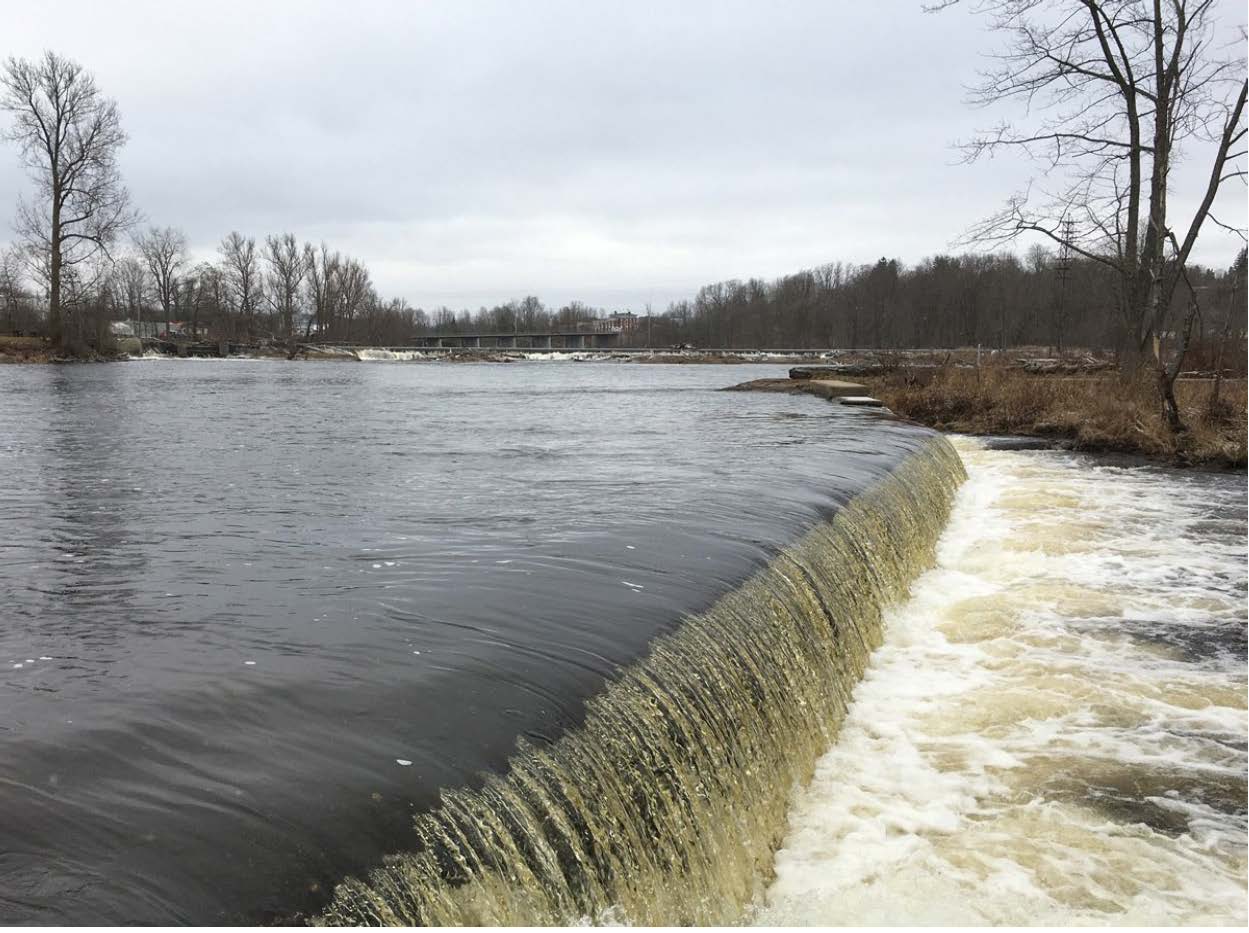
The project consists of three dams each of which direct a portion of inflow toward the powerhouse forebay:
- Tannery Dam “A” is a concrete gravity structure spillway of approximately 117 ft long integrated to the forebay via an open flume with a 63-ft-long gravity wingwall forming the powerhouse’s forebay wall and a 50 -ft-long gravity wingwall which functions as the dam’s east abutment.
- The remaining two structures, known as the Spicer Pond Dams, are concrete gravity spillways with irregular crest elevations.
- Dam “B” (Little Spicer Dam) spans Tannery and Wind Islands and is approximately 106 ft in length seasonally topped with 1 ft flashboards (with three minimum flow openings of varying widths).
- Dam “C” (Big Spicer Dam) spans approximately 279 feet between Wind and Devil Island seasonally topped with 1 ft flashboards (with five minimum flow openings of varying widths). Dam “C” also includes a wingwall angled toward the upstream Carthage Paper Makers Mill (Carthage PMM) Dam which is 98 ft long. The dams vary in height between 2 and 6 ft.
The impoundment is the tailrace/bypass reach of the Carthage PMM Dam. The Tannery Island dams create a negligible bypassed reach which flows directly into the Carthage Mill (West End) Dam impoundment.
The powerhouse is an open flume-type structure containing five Flygt submersible-type turbine/generators. Of the five turbines, three are fixed propellers and two have adjustable blades. With 12-inch flash boards, each unit produces approximately 375 kW at a net head of 15.8 ft resulting in a total installed capacity of 1,875 kW for the entire facility. Intake trashracks have 2-inch clear spacing.
The project is a run-of- river facility with a seasonally variable minimum pond elevation and a surface area of approximately 8.5 acres with a gross storage capacity of approximately 68-acre-ft. River flows into the Black River from upstream are regulated by the Hudson River – Black River Regulating District. The powerhouse and spillway discharge to an approximately 700-ft-long tailrace channel which merges with flows from the bypass reach to the impoundment of Long Falls and Carthage Mill (West End) dams.
There is no FERC-required minimum flow but the project owner has agreed to provide 106 cfs of minimum flow determined by NYSDEC to be sufficient to support dissolved oxygen levels and aquatic habitats downstream. Flashboards are seasonally installed from approximately April 15 to December 17 on Dam “B” and Dam “C”, with multiple minimum flow notches.
Waters in the project reach are considered Class C waters which are suitable for the designated uses of: fish, shellfish and wildlife propagation and fishing and primary and secondary-contact recreation. Project waters are not listed as impaired by the State of New York.
There are no migratory fish species in the project vicinity, and barriers to migration exist well downstream in Watertown NY at the Mill Street Falls. No upstream fish passage is required or provided. Resident species include pumpkinseed, smallmouth bass, golden shiner, yellow perch, rock bass, chain pickerel and walleye. Downstream passage of these species is provided via the minimum flows and spill from the dams.
Project lands are very small and consist of 8.5 acres of water and less than one acre of land. The project boundary encompasses the dams and powerhouse and follows only a portion of the reservoir shoreline Lands also include small portions of Wind and Tannery Islands. The area surrounding the project is developed into commercial and industrial sites, and roads with no ecological significance.
The only threatened or endangered species that are or may be present are Indiana bat and northern long-eared bat (both are federally and state listed). Given the project’s small footprint and lack of potential roost trees, the project is unlikely to affect these species.
There are no documented archaeological or historic sites within the project boundary and none of the project structures are listed on the National Register of Historic Properties, although due to age some could be eligible for listing. The project owner recently reached out to federally recognized Indian Tribes but has not received any responses. There are no known or identified traditional cultural properties within the project area.
There are no FERC-approved project-specific recreation facilities or access points at the project. The surrounding area is highly industrialized and comprised of several dams and powerhouses and would be unsafe for on-water recreation. Informal access to the impoundment, tailrace and bypass reaches could be gained via Tannery Island, on which the powerhouse is located, which is accessible by public ways. There are three recreation sites providing land based opportunities adjacent to the project: Long Falls Park. The Park, owned by the Town of Carthage provides parking, a walking trail and scenic views of the Black River including Tannery Island Dams “B” and “C”. The West Carthage Boat Launch is also owned by the town and features parking and a paved boat launch with courtesy dock, benches and picnic facilities and provides shoreline access to the Black River The closest public access to the Black River is downstream of the Carthage Mill (West End) and Long Falls Dams at the West Carthage boat launch. Long Falls Hydro Rec Site provides parking, picnic areas, a small trail and shoreline access to the Long Falls and Carthage Mill (West End) bypass reach and Long Falls tailrace. It is owned and maintained by the Long Falls project.
Certification History
January 23, 2026 The Low Impact Hydropower Institute has received a complete application for Low Impact Certification of the Tannery Island Hydroelectric Project. LIHI is seeking public comment on this application. Specifically, we are interested in knowing whether you think the Project meets the LIHI Low Impact Certification Criteria, as revised in the 2nd Edition Handbook in effect at the time of initial application. Please review the program and criteria in LIHI’s Handbook Revision 2.06 and then review the Project’s application materials below.
Comments that are directly tied to specific LIHI criteria (flows, water quality, fish passage, etc.) will be most helpful, but all comments will be considered. Comments may be submitted to the Institute by e-mail at comments@lowimpacthydro.org with “Tannery Island Project Comments” in the subject line, or by mail addressed to the Low Impact Hydropower Institute, 68 Harrison Ave Ste 605, PMB 113938 Boston, Massachusetts 02111-1929. Comments must be received on or before 5 pm Eastern time on March 24, 2026 to be considered. All comments will be posted to the web site and the applicant will have an opportunity to respond. Any response will also be posted.