LIHI Certificate #138 – Dundee Project, Maine


| Project Name | Dundee |
| LIHI Certificate No. | 138 |
| LIHI Certificate Term | September 5, 2017 – September 4, 2027 |
| Owner | Presumpscot Hydro LLC, a subsidiary of Relevate Power LLC |
| State | Maine |
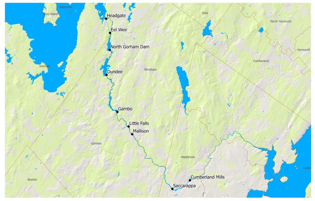
| Location | Windham & Gorham, Cumberland Counties River mile 21.9 on the Presumpscot River |
| Installed Capacity | 2.4 MW |
| Average Annual Generation | 16,000 MWH |
| Facility Type | run-of-river |
| FERC No. | P-2942 issued in 2003, expires 09/30/2053 |
The Dundee Project is located on the Presumpscot River in Cumberland County, Maine. The project is the third-most downstream of six hydroelectric facilities between Sebago Lake and the Atlantic Ocean in Portland, Maine. Upstream of the project are the Eel Weir (LIHI #137) and North Gorham (LIHI #129) projects, and downstream are the Gambo (LIHI #139), Little Falls (LIHI #140), and Mallison Falls (LIHI #141) projects. Originally constructed in 1913, the project was built to provide power to the S.D. Warren Mill. Since then, it has been continuously used to provide power to the mill. The mill has been used for papermaking and development of papermaking inventions since its purchase by Samuel Dennis Warren in 1854. Hydroelectric equipment has been replaced as necessary, but the shells of the major equipment still remain.
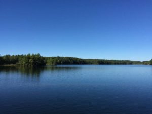
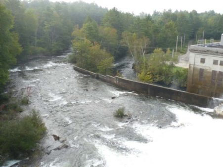
The project includes the dam, powerhouse, three turbines, bypass reach, tailrace channel, and eel lift. The dam is a 1,492-foot-long structure, comprised of a 175-foot-long, 50-foot-high earthen east embankment, a 1,050-foot-long, 50-foot-high earthen west embankment, a 90-foot-long concrete non-overflow section, a 150-foot-long, a 42-foot-high concrete spillway, and a 27-foot-long gated concrete canal intake structure. A reinforced concrete powerhouse integral to the spillway section of the dam contains three horizontal Francis turbines direct connected to the generators with a total installed capacity of 2.4 MW. A 1,075-foot-long bypass reach exists between the dam and the downstream end of the tailrace channel. The tailrace channel is 1,075 feet long, 30 feet wide and 11feet deep.
The powerhouse equipment is original, although some upgrades have been made since its original operation. The Dundee dam has undergone more significant changes since original construction in 1913, including reconstruction and raising of the east embankment, raising of the west embankment, resurfacing of the spillway section, and installation of rock anchors, most completed in 1990.
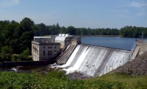
The project operates in run-of-river mode and impounds a 197-acre reservoir. The project provides seasonal minimum flows: 60 cfs from May 1-October 31 and 40 cfs from November 1-April 30. Additionally, if temperatures exceed 22 °C before 8:00 a.m., 50 cfs is spilled into the bypass in order to meet and maintain dissolved oxygen requirements. The flow regime was developed in consultation with Maine Department of Environmental Protection (MEDEP) and Maine Department of Marine Resources (MDMR), tailored to maintain riverine habitat for fish and wildlife resources.
Waters within the project reach are designated Class GPA in the impoundment and Class B downstream of the project. This area of the Presumpscot River has historically been impaired for low dissolved oxygen levels. Monitoring conducted by MEDEP confirms that increased minimum flows at the project have achieved full attainment of dissolved oxygen standards in the downstream section of the river.
Downstream dams prevent anadromous fish passage at the project. With the 2019 FERC license amendment incorporating an amended water quality certification and revised USFWS terms, anadromous fish passage is no longer required during the current FERC license term. Eel passage facilities were installed in 2007 and have been updated to provide more effective access for American eel passage. From September 1 through October 31, the project shuts down operations for 8 hours starting at sunset. This facilitates downstream migration of American eel. Shutdowns are coordinated with MDMR and USFWS to determine the most effective timing. Flows pass over the spillway and ensure safe migration into the bypass reach.
The project property consists of 115 acres not including the impoundment. A shoreline management plan was developed to maintain a buffer zone for the protection of sensitive plant species, aesthetic resources, and recreational access. The plan was developed in consultation with the National Park Service, Maine State Planning Office, Maine Department of Inland Fisheries and Wildlife, and the Casco Bay Estuary Project. The buffer zone pertains to all project lands within 200 feet of the normal high-water elevation.
Threatened and endangered species potentially within the project property include: Northern Long-eared bat, Eastern Small-footed Bat, Little Brown Bat, Brook Floater, Least Bittern, Upland Sandpiper, Eastern Box Turtle, Spotted Turtle. Activities with the potential to affect the listed species include removal of large trees that may provide roosting habitat for the bats, exposure/dewatering of the Brook Floater mussel during significant, prolonged impoundment drawdowns, loss of or fragmentation of habitat due to development for the Least Bittern, Upland Sandpiper, and Spotted Turtle, and direct taking of Box Turtles for pets. The project owner expressed that none of these activities are planned at the project. Any construction planned outside of the buffer zone must be reviewed by the Maine Natural Areas Program to ensure that listed species will not be impacted.
Cultural resources in the project vicinity include the Cumberland and Oxford Canal, the Oriental Powder Mill Complex, the Gambo Pony Truss Bridge, and Dundee Station. Dundee Station is also eligible for National Register of Historic Places listing due to its importance as an early 20th century feat of hydroelectric engineering. The project owner submits annual reports to the State Historic Preservation Office and the Penobscot Indian Nation detailing activities conducted under its historic properties management plan.
Recreational resources at the project include a canoe portage trail and a walk-in angler access point. The project improved access to the trail and provides a location for Maine Department of Inland Fisheries and Wildlife to stock fish in the river.
Compliance Status
The Certificate includes the following facility-specific conditions:
Condition 1: The Owner shall notify LIHI when the modifications to the Project to improve upstream eel passage are completed (modifications completed 2021, partially satisfied) and submit copies of MDMR and USFWS comments related to whether these modifications are sufficient, and/or if additional effectiveness testing is required to confirm that eels are safely passing upstream at the Project. If additional testing is required, the schedule and final results along with agency comments on the report, agency recommendations for modifications, and plans and schedule for any needed modifications to shall also be provided to LIHI.
Condition 2: The Owner shall update LIHI on the following activities in the annual LIHI compliance statement:
a) The status of Condition 1 above.
b) Satisfied in 2019 with FERC amendment. The status of upstream and downstream anadromous fish passage activities at the Project and at the Saccarappa Project. The updates should include summaries of agency and stakeholder consultation and recommendations made, any changes in the fish passage plans from those described in the LIHI application, and any changes in passage requirements or the timing of implementation at both Projects. LIHI reserves the right to suspend its certification if the agencies do not determine that safe passage at the Project is being provided and that such passage needs have not been waived.
c) A summary of any consultation with MIF&W and/or USFWS related to state or federally listed species identified as possibly occurring at the site that could be impacted by construction activities or non-routine operations or maintenance activities. This would also include impoundment drawdowns that would expose a significant portion of the river bottom, and any activities affecting lands outside of the existing 100-foot conservation buffer zone adjacent to the impoundment, among other non-routine activities. A summary of the relevant triggering activities and the measures implemented during the year to protect such species shall also be provided.
2024: No material changes or compliance issues were identified. The project remains in compliance based on the annual review. For Condition 1 and 2a, the project filed the 2023 eel passage effectiveness study report with FERC, including agency comments and responses. For Condition 2c, the project reported no activity.
2023: No material changes or compliance issues were identified. The project remains in compliance based on the annual review. For Condition 1 and 2a, the project reported that eel passage effectiveness studies were completed in 2023. For Condition 2c, the project reported no activity.
2022: No material changes or compliance issues were identified. The project remains in compliance based on the annual review. For Condition 1 and 2a, the project reported modifications to the upstream eel approach were made in 2021, and agency consultation on additional testing will be completed in 2022. For Condition 2c, the project reported no activity.
2021: There were no reported changes or compliance issues. The project remains in compliance based on the annual review. For Condition 1 and 2a, the project reported completion of upstream eel passage modifications and agency approval to conduct effectiveness testing in 2023. For Condition 2c, the project reported no activity.
2020: There were no reported changes or compliance issues. The project remains in compliance based on the annual review. For Condition 1 and 2a, the project reported no change in status, anticipating completion of modifications in 2021. For Condition 2c, the project reported no activity.
2019: There were no reported changes or compliance issues. The project remains in compliance based on the annual review. For Condition 1 and 2a the project reported no change in status due to high flows. For Condition 2b, the project reported that removal of the Saccarappa dam had begun and the FERC license amendment incorporating an amended water quality certification and revised USFWS terms, anadromous fish passage is no longer required during the current FERC license term. For Condition 2c, the project reported no activity.
2018: There were no reported changes or compliance issues. The project remains in compliance based on the annual review. For Condition 1 and 2a, the project reported no change in status. For Condition 2b, the project reported filing with FERC of the Saccarapa project license surrender application. For Condition 2c, the project reported completion of small whorled pogonia monitoring.
Certification History
January 1, 2022: The LIHI Certificate term has been extended in accordance with Revision 2.05 of the LIHI 2nd Edition Certification Handbook issued January 1, 2022. Refer to the facility table above for the new term.
March 5, 2018 – The 30-day appeal window closed for the preliminary certification decision of the Dundee Hydroelectric Project closed on March 1, 2018 with no appeals to the decision received. The decision is therefore final and Dundee is LIHI Certificate #138. The Certificate term will be September 5, 2017 – September 4, 2022.
January 30, 2018 – On January 24, 2018, the Low Impact Hydropower Institute (LIHI) preliminarily approved Low Impact Certification for the Dundee project. This decision is preliminary pending the 30-day appeal window. Only those who commented in the initial application 60-day comment period are eligible to file an appeal. Such appeal needs to include an explanation as to how the project does not meet the LIHI criteria. Appeal requests can be submitted to comments@lowimpacthydro.org. Requests must be received by 5:00 pm Eastern time March 1, 2018.
September 7, 2017 – On September 7, 2017, the Low Impact Hydropower Institute (LIHI) received a complete application from S.D. Warren Company d/b/a Sappi North America for the Low Impact Certification of the Dundee Project, FERC No. P-2942, located on the Presumpscot River.
LIHI is seeking comment on the Dundee application for certification. Comments that are directly tied to specific LIHI criteria (flows, water quality, fish passage, etc.) will be most helpful, but all comments will be considered. Comments may be submitted to the Institute by e-mail at comments@lowimpacthydro.org with “Dundee Project Comments” in the subject line, or by mail addressed to the Low Impact Hydropower Institute, 329 Massachusetts Avenue, Suite 2, Lexington, MA 02420. Comments must be received at the Institute on or before 5 pm Eastern time on November 7, 2017 to be considered. All comments will be posted to the web site and the applicant will have an opportunity to respond. Any response will also be posted.
Certification Files
2017 Certification
- Dundee Certification Review Report 2017
- Dundee Certification Application 2017
- Conservation Law Foundation/Friends of the Presumpscot River Comment Letter – Sappi Maine Projects 2017
- Sappi Response to Conservation Law Foundation/Friends of the Presumpscot River Comment Letter
Key Documents
- Presumpscot Projects FERC License Amendment 2019
- Presumpscot Projects FERC License Amendment and Amended Water Quality Certificate 2017
- Presumpscot Projects FERC License Amendment and Amended Water Quality Certificate 2016
- Presumpscot Projects Settlement Agreement 2016
- Dundee FERC License and Water Quality Certificate 2003
- Presumpscot Projects FERC Environmental Impact Statement 2002 Part 1
- Presumpscot Projects FERC Environmental Impact Statement 2002 Part 2
