LIHI Certificate #81 - Arrowrock Project, Idaho
| Project Name | Arrowrock |
| LIHI Certificate No. | 81 |
| LIHI Certificate Term | September 20, 2021 – September 19, 2031 |
| Owner | Boise Kuna Irrigation District et al |
| State | Idaho |
| Location | River Mile 75.7 on the Boise River |
| Installed Capacity | 15 MW |
| Average Annual Generation | 70,541 MWh |
| Facility Type | Run-of-release |
| FERC No. | P-4656, issued in 1989, expires 02/28/2039. |
The Arrowrock Project is located on the Boise River in southwest Idaho about 22 miles upstream of the City of Boise in Elmore and Ada Counties. It is part of the Columbia River network of dams. Arrowrock Dam was constructed in 1915 and is owned and operated by the US Bureau of Reclamation (USBR), one of four federal dam developments within the upper Boise River watershed. Upstream is the Anderson Ranch Dam and hydro project constructed in 1950 and located on the South Fork Boise River. About 11 miles downstream of Arrowrock is the Lucky Peak dam constructed in 1955 owned and operated by the US Army Corps of Engineers (USACE). The Lucky Peak impoundment backwaters to the base of Arrowrock dam. Farther downstream is the Boise River Diversion Dam and hydro project constructed in 1909 and owned and operated by USBR. This dam diverts irrigation water to the New York Canal about 14.2 miles downstream of Arrowrock.
Arrowrock is part of the USBR “Boise Project” which includes five storage dams, two diversion dams, three power plants, 721 miles of canals, seven pumping stations, 1,323 miles of laterals, and 649 miles of drains. The Boise Project furnishes irrigation water to about 390,000 acres in southwestern Idaho and eastern Oregon.
The Boise River drains an area of 4,100 square miles. The mainstem is formed by the convergence of the North and Middle forks of the Boise River to the northeast of Arrowrock reservoir. The headwaters originate in the Sawtooth Mountains at elevations exceeding 10,000 feet. The river’s forks generally flow in a southwesterly direction before emptying 102 miles later into the Snake River near Parma, Idaho. The South Fork of the Boise River also feeds Arrowrock reservoir. Below the South Fork confluence, the river flows westerly and is fed also by Mores Creek, a major tributary that enters Lucky Peak reservoir. Arrowrock reservoir’s contributing watershed area is 2,210 square miles, and all inflows are appropriated for irrigation use and flood control.
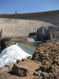
Arrowrock Dam was constructed in 1915 and was the tallest dam in the world at that time at 350 feet. It has a spillway length of 1,150 feet with an upstream depth of 257 feet. When full, the reservoir has a surface area of 3,100 acres and a length of 12.8 miles. Two series of ten outlet conduits extend through the dam to provide irrigation releases at centerline elevations of 3,018 feet msl and 3,105 feet msl; the project penstocks are tied into two conduits in the lower of the two tiers. Clamshell gates installed on the downstream end of each conduit are used to control water releases through the dam. There is also an overflow side‐channel spillway which is used occasionally to release water for flood control using six drum gates that are six feet high with an invert elevation of 3,210 feet msl.
The hydro project was proposed in the 1980s by a group of local irrigation districts that included the Boise‐Kuna Irrigation District, Nampa & Meridian Irrigation District, New York Irrigation District, Wilder Irrigation District, and Big Bend Irrigation District (the licensees). The hydro facility is located on the south side of the river directly below the dam. The powerhouse is sited entirely on USBR lands, although Arrowrock Reservoir and the upper end of Lucky Peak Reservoir are located within the Boise National Forest. The hydro facility includes two 58‐inch-diameter, 120‐foot‐long steel penstocks, a powerhouse, two 7.5‐MW Francis turbine generating units, a 55‐foot‐wide, 125‐foot‐long tailrace discharging into Lucky Peak Lake, a control weir located at the downstream end of the tailrace to ensure draft tube submergence when Lucky Peak Reservoir is drawn down, and electrical transmission infrastructure. The two penstocks divert flows at bifurcations located at the downstream end of two of the ten dam outlet conduits (No. I and No. 2 conduits). The remaining eight outlet conduits continue to discharge directly into Lucky Peak Reservoir when daily releases exceed those that pass through the powerhouse.
The project operates in a run-of-release mode using available inflow from Arrowrock Reservoir. The reservoir retains most of the snowmelt during winter and early spring and is the first to be drawn down to meet irrigation demands in July through September. Releases utilized for electricity production are allocated by USBR and allow for daily power shaping releases, which follow the hourly changes in the need for power. This enables the hydro facility to generate during daily peak power demand periods as long as the overall volume of water released each day remains within the daily allocation and meets USBR’s irrigation and flood control requirements. Project flows exceed turbine capacity between April and August of each year, thus daily shaping does not typically occur during that period. From November to March daily flow shaping occurs about half the time. From May 1 through June 30 the project is not allowed to shape flow releases in order to protect smallmouth bass incubation and spawning. Run-of-river operations are implemented in May and June to alleviate any impact on bass populations.
Waters within the project reach are designated Category 2, fully supportive of assessed beneficial uses including cold-water aquatic biota, primary contact recreation, and salmon spawning. The project owner continuously monitors dissolved oxygen concentrations and has procedures in place to ensure dissolved oxygen concentrations are supportive of aquatic biota. Several other plans/procedures have been implemented to control erosion and sedimentation as well as prevention of water contamination.
Historically, anadromous species like Chinook salmon were able to access waters within the project reach in the mid-1800s. The construction of dams downstream precluded access for migratory species prior to the Arrowrock Dam’s construction in 1915. The Lucky Peak Dam was constructed by USACE in 1955 as a flood control facility, immediately downstream of Arrowrock Dam and has no upstream fish passage facilities. The Arrowrock Reservoir supports a mixed fishery consisting of yellow perch, smallmouth bass, mountain whitefish, rainbow trout, wild redband trout, and bull trout. A warmwater inshore fishery is present along the shoreline of Lucky Peak Lake. Smallmouth bass dominate this area. Rainbow trout and kokanee which are coldwater species, are also present in Lucky Peak Lake due to stocking efforts. US Fish and Wildlife Service (USFWS) determined that the risk of fish mortality by entrainment through the turbines is low.
The project lands consist of 5 acres. The surrounding lands are dominated by a shrub-steppe vegetative community. In higher elevations, the land transitions to coniferous forest. The steep hillsides are primarily undeveloped with ownership under federal jurisdiction. Run-of-release and run-of-river operations minimize any potential for adverse impacts by the project.
Threatened or endangered species potentially present in the project vicinity include bull trout. The species is found in both Arrowrock and Lucky Peak reservoirs as well as upstream of Arrowrock reservoir. Consultation with USFWS concluded that the potential for entrainment of this species is not exacerbated by project operations.
Arrowrock Dam is listed on the National Register of Historic Places. Other than the dam itself, no other sites were listed as potentially impacted by construction or operation of the hydro project. The powerhouse was built to blend with the existing dam to preserve historic integrity and procedures have been adopted in case other historic or cultural resources are identified.
There are no recreational resources associated with the project although resources are available in the vicinity. Arrowrock Reservoir includes access for fishing, tubing, camping, picnicking, hiking, and hunting. Downstream of the project, public recreation for waterskiing, boating, fishing, swimming, and picnicking is provided. Consultation with the US Forest Service concluded that project operations do not impede recreational access or the natural resources in the vicinity. Public access is provided free of charge.
Compliance Status
There are no facility-specific conditions in the current Certificate.
2025: No material changes or compliance issues were identified. The project remains in compliance based on the annual review.
2024: No material changes or compliance issues were identified. The project remains in compliance based on the annual review.
2023: No material changes or compliance issues were identified. The project remains in compliance based on the annual review.
2022: No material changes or compliance issues were identified. The project remains in compliance based on the annual review.
2021: Annual reporting for the current Certificate has not yet taken effect.
Certification History
January 5, 2022: The Low Impact Hydropower Institute has issued a final decision on the certification of the previously certified Arrowrock Project. The 30-day appeal window closed on December 31, 2021 and no appeals were filed. Therefore, the decision to recertify the project is now final. The new term is September 20, 2021 through September 19, 2031, reflecting the extended terms for Certificates that became effective on January 1, 2022.
November 29, 2021: The Low Impact Hydropower Institute (LIHI) has preliminarily approved the Arrowrock Project for a 5-year term of Low Impact Certification. This decision is preliminary pending the 30-day appeal window. Only those who commented on the initial application during the 60-day comment period are eligible to file an appeal. Such appeal needs to include an explanation as to how the Project does not meet the LIHI criteria. Appeal requests can be submitted by email to comments@lowimpacthydro.org with “Arrowrock Project” in the subject line, or by mail addressed to the Low Impact Hydropower Institute, 1167 Massachusetts Ave, Office 407, Arlington, MA 02476. All requests will be posted to the website. The applicant will have an opportunity to respond and any response will also be posted. Requests must be received by 5 pm Eastern time on December 29, 2021. The full application and reviewer’s report are available below. If no appeal requests are received and the decision becomes final, the Certification term for the Project will be September 20, 2021 through September 19, 2026.
September 22, 2021:The Low Impact Hydropower Institute has received a complete application for Low Impact Reinstatement of the Arrowrock Project (formerly LIHI #81) . LIHI is seeking public comment on this application. Specifically, we are interested in knowing whether you think the Project meets the LIHI Low Impact Certification Criteria, as revised in the 2nd Edition Handbook. Please review the program and criteria in LIHI’s revised Handbook and then review the Project’s application materials below. Comments that are directly tied to specific LIHI criteria (flows, water quality, fish passage, etc.) will be most helpful, but all comments will be considered. Comments may be submitted to the Institute by e-mail at comments@lowimpacthydro.org with “Arrowrock Project Comments” in the subject line, or by mail addressed to the Low Impact Hydropower Institute, 1167 Massachusetts Avenue, Arlington, MA 02476. Comments must be received on or before 5 pm Eastern time on November 20, 2021 to be considered. All comments will be posted to the web site and the applicant will have an opportunity to respond. Any response will also be posted.